1. Get your spatial data ready. If you’re just starting to work with spatial data and don’t have a handy .shp file, you can visit some of these sites which provide publicly available shapefiles:
http://www.vdstech.com/map_data.htm
http://wwwn.cdc.gov/epiinfo/script/shapefiles.aspx
http://www.mapcruzin.com/download-free-arcgis-shapefiles.htm
http://www.census.gov/geo/www/cob/bdy_files.html
2. Download the SQL Server Spatial Tools from ArcGIS, which include the Shape2SQL tool.
Archive for February 27th, 2011
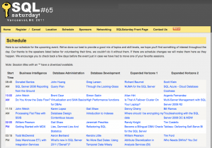
Thank you to all the troopers who attended my really-early-morning-cold-and-snowy session at SQLSaturday#65 in Vancouver, BC. It was such a great event; thanks to all volunteers, sponsors, speakers and organizers (kudos to Scott Stauffer (blog | twitter) .. Thanks to Todd McDermid (blog | twitter) too for helping me give out swags during my session, and thanks for the great powerpoint slide decks which I’ve used in 2 SQLSaturdays now! 
As promised, here are the SQLSaturday#65 presentation materials for SQL Server 2008/2008 R2 Reporting Services from the Ground Up
Brent Ozar (blog | twitter) has a few pictures of the event 
Sample Reports (pdfs)
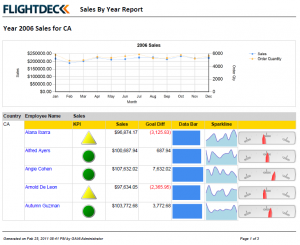
Report with different visualization components (data bar, sparkline, indicator, gauge, chart)
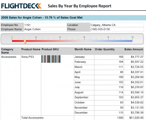
Report with drilldown, barcode, gauge
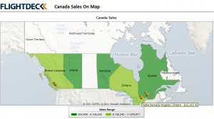
Report using map (from ESRI shapefile for Canada) and Bing Maps layer
Read the rest of this entry »
